Blizzard warnings across Northeast as up to 2 feet of snow projected for NYC and Boston
#Blizzard warnings#Northeast snowstorm#New York City snow#Coastal flooding#Winter storm 2026#Travel disruptions#Emergency alerts
📌 Key Takeaways
35 million people under blizzard warnings from Maryland to New Hampshire
Up to 2 feet of snow expected in NYC and Boston with dangerous travel conditions
First blizzard warning for NYC since 2017 and Philadelphia since 2016
Coastal flooding concerns with 21 million people under alerts
📖 Full Retelling
Roughly 35 million people across the Northeast from Maryland to New Hampshire are under blizzard warnings on February 22, 2026, as a powerful winter storm threatens to bring up to 2 feet of snow and strong winds to major cities including New York City and Boston, with coastal flooding concerns also emerging. The storm began as rain and snow showers on Sunday morning across the mid-Atlantic and Northeast regions, with a low-pressure system expected to intensify as it moves up the coast. New York City Mayor Zohran Mamdani warned residents that 'We haven't seen a storm like this in a decade' with some parts of the city potentially receiving up to 28 inches of snow. The strongest part of the storm is expected during the evening and overnight hours into Monday morning, with the possibility of 2-4 inches of snowfall per hour and wind gusts reaching 50-70 mph. Travel conditions are expected to become exceptionally dangerous as visibility drops under a quarter of mile and deep snowdrifts develop. In addition to the snow, coastal flooding poses significant threats, with 21 million people under alerts from Maryland to Maine, as vulnerable waterfront areas face particular risk due to the combination of high tides and strong wind gusts.
Coastal flooding occurs when dry and low-lying land is submerged (flooded) by seawater. The range of a coastal flooding is a result of the elevation of floodwater that penetrates the inland which is controlled by the topography of the coastal land exposed to flooding. The seawater can flood the land...
The blizzard warning is the first for NYC since 2017 and Philadelphia since 2016, indicating an unusually severe winter storm. Up to 2 feet of snow and 70 mph winds threaten major transportation and public safety across the Northeast.
Context & Background
35 million people under blizzard warnings from Maryland to New Hampshire
Projected snowfall 1-2 feet in NYC and Boston, up to 18 inches in Philadelphia
Coastal flooding alerts for 21 million people from Maryland to Maine
What Happens Next
The storm is expected to subside by Monday afternoon, but strong winds and snow will continue into the weekend. Authorities advise staying indoors, monitoring travel advisories, and preparing for possible power outages.
Frequently Asked Questions
What is a blizzard warning?
A blizzard warning means sustained winds or gusts of 35 mph or higher and visibility less than a quarter mile for at least three hours.
How should people prepare for the storm?
Stay indoors, avoid travel, stock up on food and water, and keep emergency supplies ready.
Will the storm affect flights?
Many airports will likely cancel or delay flights, and travelers should check with airlines for updates.
}
Original Source
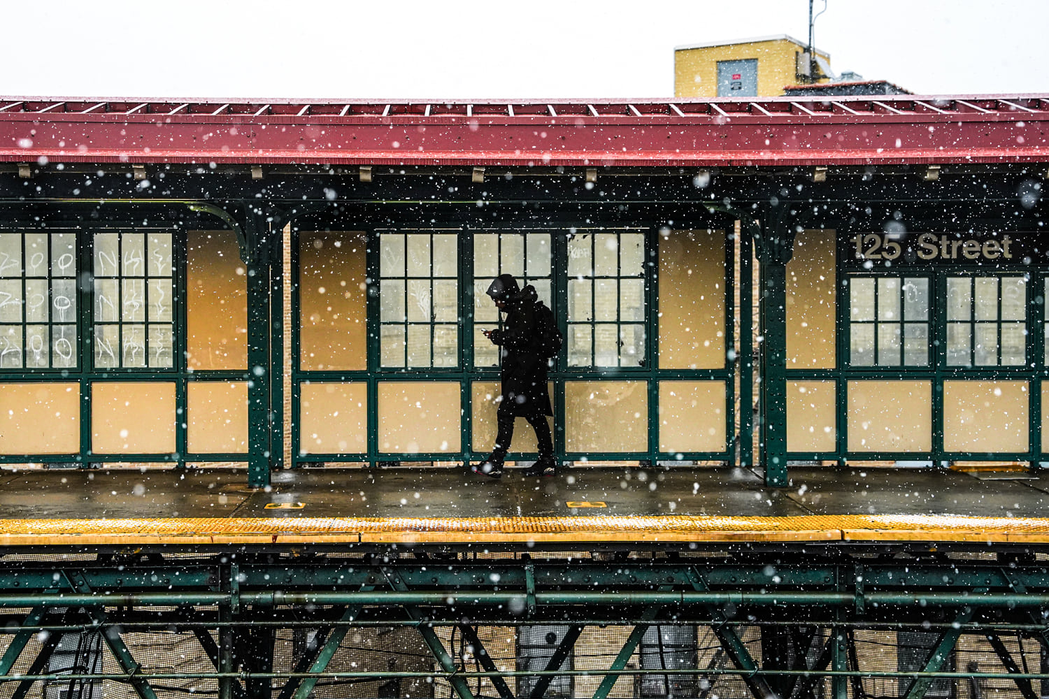
Blizzard warnings across Northeast as up to 2 feet of snow projected for NYC and Boston The blizzard warning is the first issued for New York City since 2017 and for Philadelphia since 2016. Snowfall at the 125th Street subway station in New York City on Sunday. A blizzard warning has been issued for large areas of the East Coast, including New York City. Ryan Murphy / Getty Images Share Add NBC News to Google Feb. 22, 2026, 11:57 AM EST By Mirna Alsharif and Christine Rapp Listen to this article with a free account 00:00 00:00 Roughly 35 million people are under blizzard warnings from Maryland to New Hampshire as a powerful winter storm threatens to bring up to 2 feet of snow and strong winds to parts of the region. On Sunday morning, rain and snow showers began to filter in across the mid-Atlantic and Northeast regions. The low-pressure system will continue to intensify as it moves up the coast in the afternoon, spreading heavy snow and gusty winds. “We haven’t seen a storm like this in a decade. Some parts of the city could see up to 28in,” New York City Mayor Zohran Mamdani warned on social media. The strongest part of the storm will come during the evening and overnight hours into Monday morning, with the possibility of 2-4 inches of snowfall per hour and 50-70 mph wind gusts. Travel conditions will be exceptionally dangerous, with visibility dropping under a quarter of a mile and deep snowdrifts expected to develop. Projected snowfall totals for New York City and Boston range from a foot to 2 feet of snow. Philadelphia could receive up to 18 inches of snow, while Washington, D.C., is forecast to get 3 to 6 inches. This is the first blizzard warning issued for New York City since 2017 and for Philadelphia since 2016. The last time all of New Jersey was under a blizzard warning was in 1996, while the last time all of Delaware was under a blizzard warning was 2010. A rain and snow mix began falling in parts of New York City on Sunday morning as whiteout condition...