
Google Earth risked ruin with retracted AI tool for making fake satellite pics
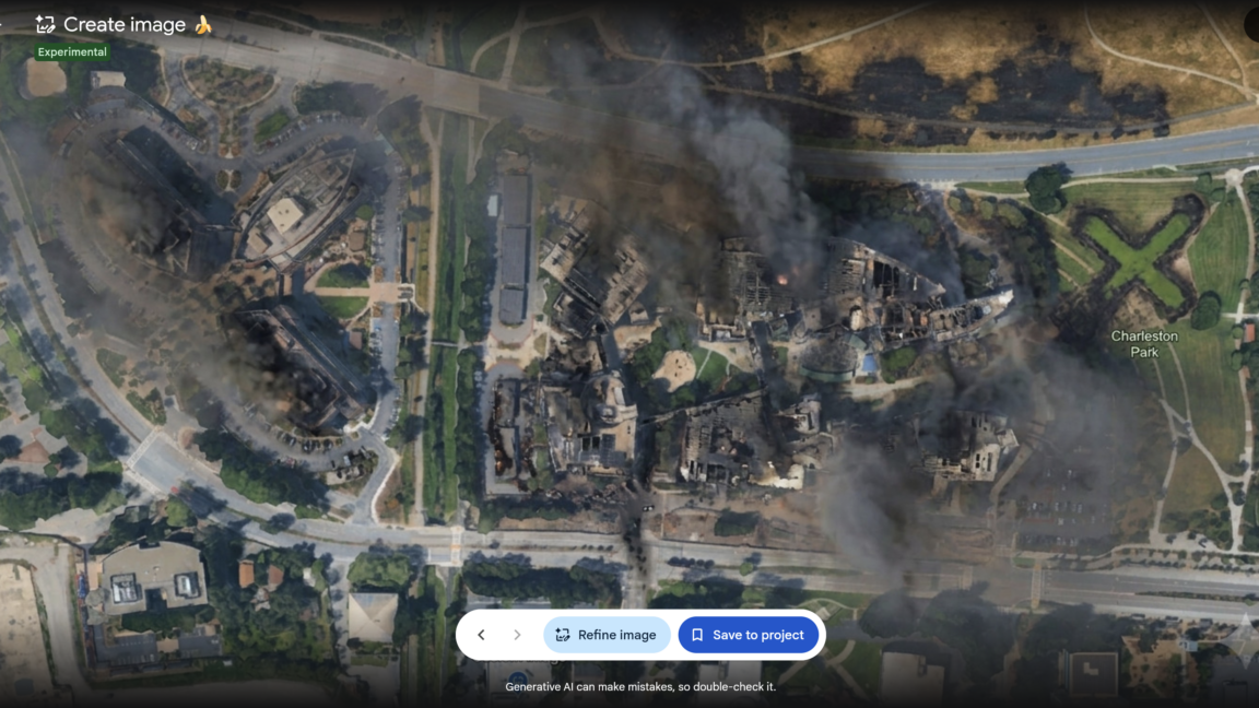


Google briefly allowed anyone to create AI-modified versions of satellite imagery available in Google Earth—before quickly reversing its decision as people shared examples of AI-generated pictures that illustrated the potential for misinformation and disinformation. There is no shortage of generative AI tools that already allow people to create AI-modified images of real buildings and cities based on user prompts.
Reported by 3 outlets — Ars Technica, The Verge. See all sources ↓
Google briefly allowed anyone to create AI-modified versions of satellite imagery available in Google Earth—before quickly reversing its decision as people shared examples of AI-generated pictures that illustrated the potential for misinformation and disinformation. There is no shortage of generative AI tools that already allow people to create AI-modified images of real buildings and cities based on user prompts. But Google’s aborted attempt to incorporate its Nano Banana 2 AI image generator as a Google Earth feature made it even easier for anyone to create modified versions of authentic imagery depicting real locations—something that Google boasted about when initially promoting the new feature. “For the first time, you can generate custom images using Google Earth’s satellite, aerial, and 3D imagery alongside Nano Banana, which creates concepts grounded in the real world,” wrote Bryan Horowitz, product manager for Google Earth, in a company blog post on July 30.Read full article Comments
Read the full report at Ars Technica ↗
Why it matters
3 outlets are covering this world story — one to watch as reporting develops.
- What's the story?
- Google briefly allowed anyone to create AI-modified versions of satellite imagery available in Google Earth—before quickly reversing its decision as people shared examples of AI-generated pictures that illustrated the potential for misinformation and disinformation. There is no shortage of generative AI tools that already allow people to create AI-modified images of real buildings and cities based on user prompts.
- How widely is it covered?
- 3 outlets, average source rating 6.3/10.
- When was it last updated?
- 12m ago.
How outlets are framing the same story
Here's how each outlet is covering the story — compare their headlines and timing at a glance.
- Coverage card2 outlets1CoverageScouting report
Google Earth risked ruin with retracted AI tool for making fake satellite pics
Sources2TypeCoverageArs Technica
The Verge