
Guinea-Bissau Tidal Waters
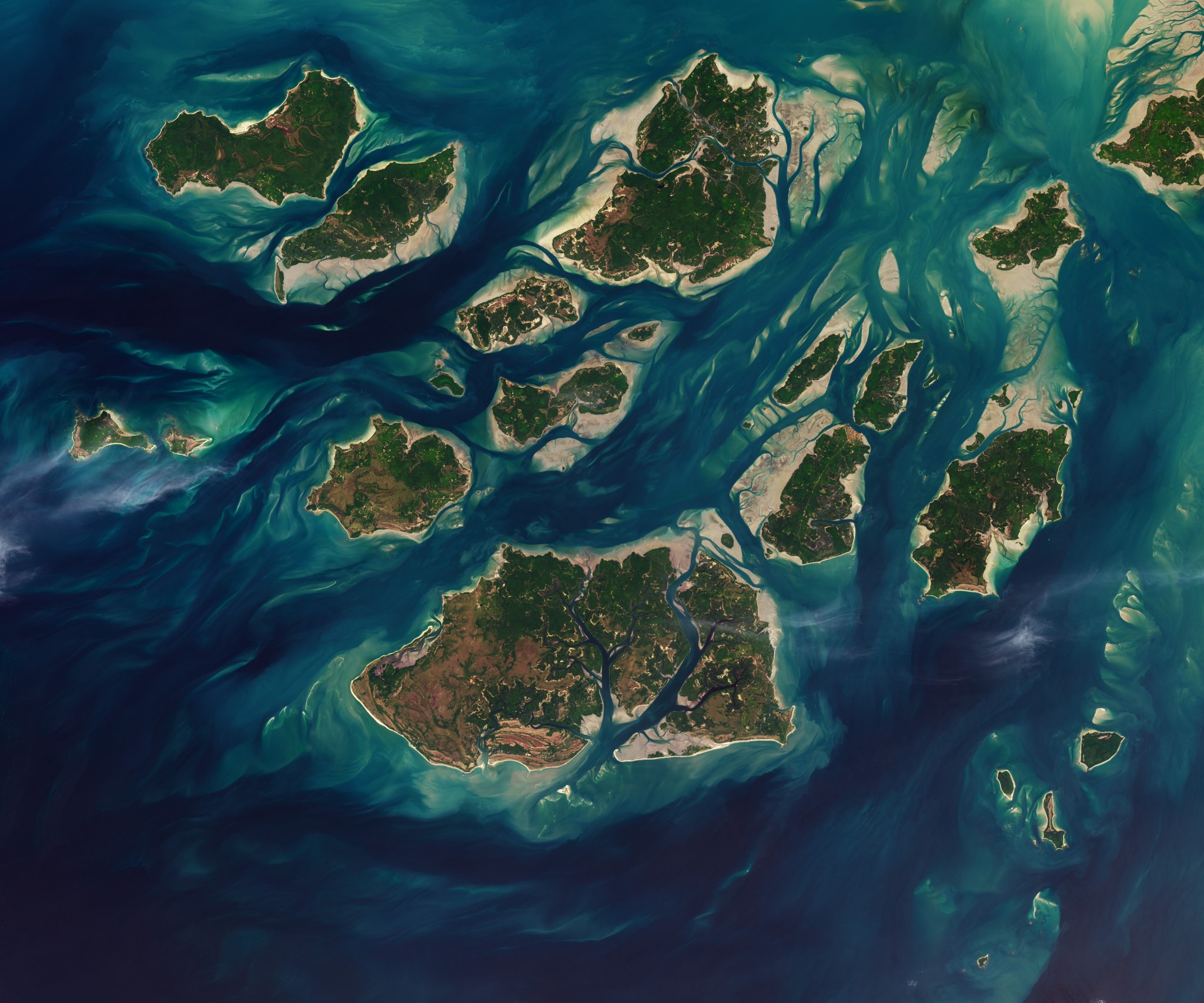
NASA/Lauren Dauphin, USGS Twice each day, tides ebb and flow through a maze of sandy channels, mudflats, and mangrove forests that flank the 88 islands and islets of Guinea-Bissau’s Bijagós Archipelago (Arquipélago dos Bijagós in Portuguese). Seen from above in this image from Nov.
Reported by 1 outlet — NASA. See all sources ↓
NASA/Lauren Dauphin, USGS Twice each day, tides ebb and flow through a maze of sandy channels, mudflats, and mangrove forests that flank the 88 islands and islets of Guinea-Bissau’s Bijagós Archipelago (Arquipélago dos Bijagós in Portuguese). Seen from above in this image from Nov. 28, 2025, the process leads to stark changes to the landscape: around low tide, intertidal mudflats and sandflats emerge from the sea, causing islands to grow significantly before shrinking again hours later. Learn more about the region and its wildlife.
Read the full report at NASA ↗
Why it matters
A world story we're tracking; its significance and source trust firm up as more outlets confirm it.
- What's the story?
- NASA/Lauren Dauphin, USGS Twice each day, tides ebb and flow through a maze of sandy channels, mudflats, and mangrove forests that flank the 88 islands and islets of Guinea-Bissau’s Bijagós Archipelago (Arquipélago dos Bijagós in Portuguese). Seen from above in this image from Nov.
- How widely is it covered?
- 1 outlet, average source rating 9.0/10.
- When was it last updated?
- 16m ago.
How outlets are framing the same story
Here's how each outlet is covering the story — compare their headlines and timing at a glance.
- Coverage card1 outlet1CoverageScouting report
Guinea-Bissau Tidal Waters
Sources1TypeCoverageNASA